| www.lfweathercenter.com | HOME |
- Home
- Radar
- Forecast
- Severe Outlook
- Satellite
- Maps
- Graphs
- Gauges
- Reports
- History
- Nearby WX
- Links
- About
- Site Map
| L I B E R T Y F A I R F I E L D W E A T H E R C E N T E R | |
 |
T R I - S T A T ER A D A R |
| - Image Swap -- KILN - | |
| ↓ ↓ ↓ Scroll down to view other Tri-State radar products ↓ ↓ ↓ |
| current NWS Level 3 radar status |
| P r i m a r y D i s p l a y |
| Mouseover the labels below to see other products |
| [ Base Reflectivity ] - [ Composite Reflectivity ] - [ Base Velocity ] - [ Storm Relative Velocity ] |
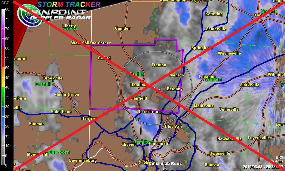 |
| Warning Box Colors: Flash Flood Severe Thunderstorm Tornado Page loaded: 2026/05/13 - 05:03:15Z |
| CAUTION: Always check time-stamp to verify latest radar image is being displayed ↑ ↑ ↑ ↑ ↑ ↑ ↑ ↑ ↑ ↑ ↑ ↑ ↑ ↑ REFRESH your browser if a more current image may be available |
| ↓ ↓ ↓ Scroll down to view other Tri-State radar products ↓ ↓ ↓ |
| S t o r m M a r k e r L e g e n d Storm Tracks are one hour in length, but Heavy Rain or Damaging Winds may precede the storm core. 
|
| Click HERE for a list of Storm Report Icons and sample warnings |
| S t o r m A n a l y s i s T o o l s |
| Mouseover the labels below to see other products |
| [ Echo Tops ] - [ Vertically Integrated Liquid ] - [ Hydrometeor Classification Algorithm ] |
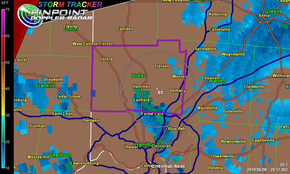 |
| Warning Box Colors: Flash Flood Severe Thunderstorm Tornado Page loaded: 2026/05/13 - 05:03:15Z |
| CAUTION: Always check time-stamp to verify latest radar image is being displayed ↑ ↑ ↑ ↑ ↑ ↑ ↑ ↑ ↑ ↑ ↑ ↑ ↑ ↑ REFRESH your browser if a more current image may be available |
| E s t i m a t e d P r e c i p i t a t i o n T o t a l s |
| Mouseover the labels below to change the interval shown |
| [ 1 Hour Accumulation ] - [ Storm Total Accumulation ] |
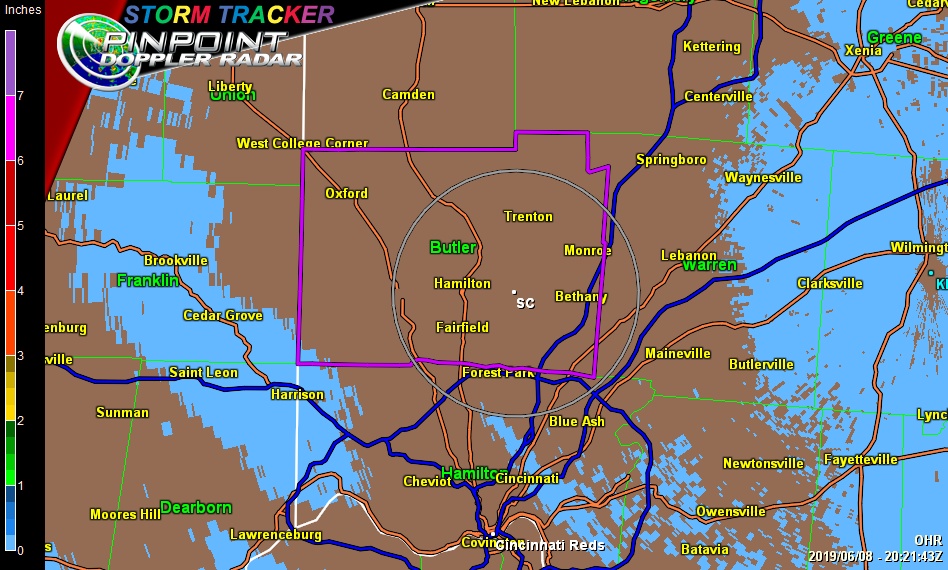 |
| Image loaded: 2026/05/13 - 05:03:15Z |
| CAUTION: Always check time-stamp to verify latest radar image is being displayed ↑ ↑ ↑ REFRESH your browser if a more current image may be available |
| Doppler Radar 101 |
| Doppler Radar 201 |
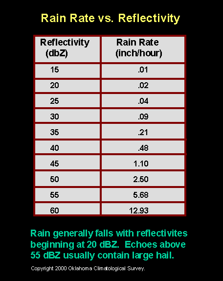
| Rain Rate vs. Reflectivity |
| General Radar (WSR-88D) Interpretation |
| Radar Beams and Ground Clutter |
| Volume Coverage Patterns and Tilt Elevations |
| NWS Radar Images |
| Composite vs Base Reflectivity (mouse over image for comparison) |
| Storm Relative Motion (mouse over image for example) |
| Why a Hail Spike forms on radar |
| Features to look for on radar |
| Bounded Weak Echo Region |
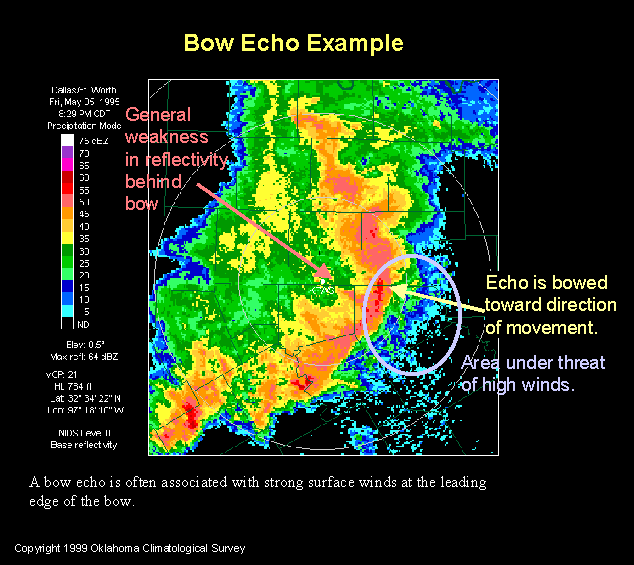
| Bow Echo |
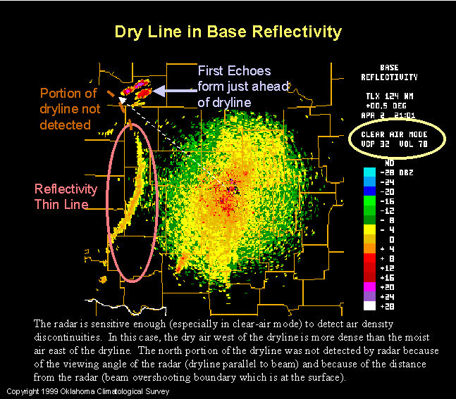
| Dry Line |
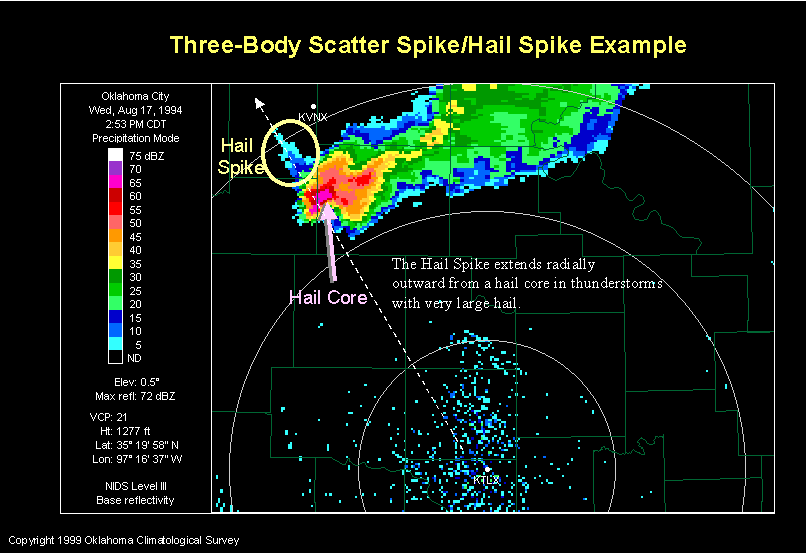
| Hail Spike (Three-Body Scatter Spike) |
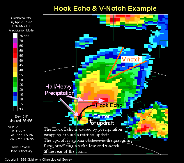
| Hook Echo |
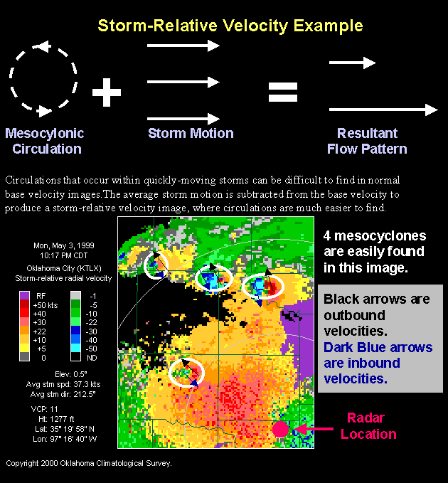
| Mesocyclone in Storm-Relative Velocity |
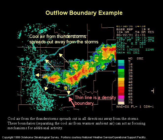
| Outflow Boundary |
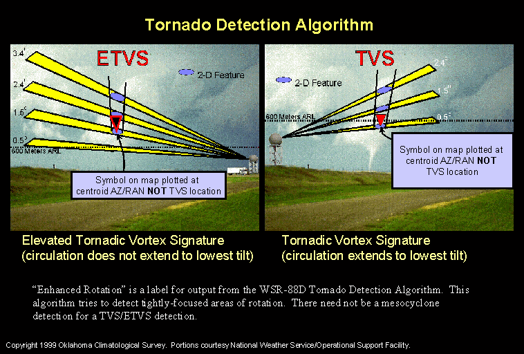
| Tornado Detection Algorithm |
| Bright Bands (winter) |
| KILN Radar Coverage West of Wilmington Ohio |

|
Never base important decisions on this
or any weather information obtained from the Internet