| www.lfweathercenter.com | HOME |
- Home
- Forecast
- Severe Weather Outlook
- Satellite
- Maps
- Graphs
- Gauges
- Reports
- History
- Links
- About
- Site Map
- Mason MI


Gauges updated every 5 minutes
- Precipitation -
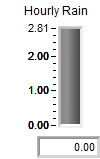
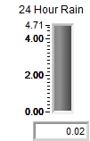
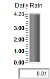
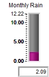
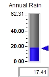
Top of each gauge represents the maximum value ever recorded by this weather station
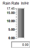
- Current Rainfall Rate -
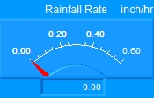
If the meter above shows red horizontal bars - use the gauge below.
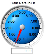
0.01 - 0.09 = Light Rain
0.10 - 0.29 = Moderate Rain
0.30 - 1.00 = Heavy Rain
1.01 - 3.00 = Very Heavy Rain
3.01 - 6.00 = Extremely Heavy Rain
Greater than 6.00 = Dangerously Heavy Rain
Maximum ever recorded = 17.45 inches per hour
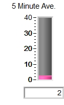
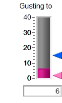
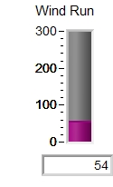
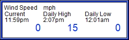
- Wind -
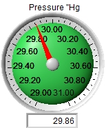
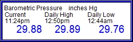
Local Average Pressure is 30.02"
Record Low = 28.81" (Jan, 26, 1978 - "Severe Blizzard")
Record High = 30.93" (Jan. 18, 1921)
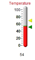
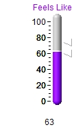
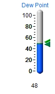
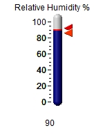
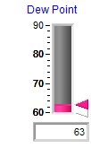
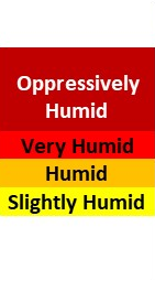
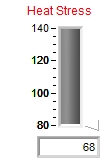
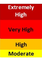
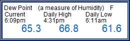
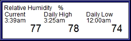
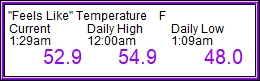
- Humidity Index & Heat Stress Index -
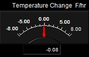
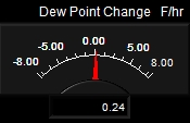
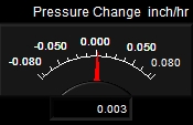
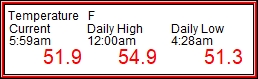
- Current Weather Trends -
|
- Today's Weather Summary - |
|
|
|
Never base important decisions on this or
any weather information obtained from the Internet
Updated
Automatically by Ambient Weather's Virtual Weather Station V14.00
Data Collected by Davis Vantage Pro2 Weather Station